Hiking Mount San Jacinto

There are amazing all-season hikes to the top of Mount San Jacinto near Palm Springs high above Coachella Valley.

San Jacinto Peak is 10,834 ft. and was known to Cahuilla Indians as I a kitch (or Aya Kaich), meaning “smooth cliffs”.

The Palm Springs Aerial Tramway hike is the less strenuous option. My son and his friend climbed all the way up and it’s not easy, but taking the tram (which is SUPER SUPER scary) is a perfect way to enjoy what John Muir referred to as “The view from San Jacinto is the most sublime spectacle to be found anywhere on this earth!”

Spectacular view.

We see beauty all around.

Palm Springs

I especially love the contrast of these stark white branches against the blue sky.

Big Sur Magic

One of my favorite places on earth, and yes, the water really is that beautiful turquoise color.

Photo by Enchanted Seashells

McWay Falls is an 80-foot-tall waterfall on the coast of Big Sur in central California that flows year-round into the Pacific Ocean from McWay Creek in Julia Pfeiffer Burns State Park, about thirty-seven miles south of Carmel.

During high tide, it’s a tidefall, a waterfall that empties directly into the ocean.

The waterfall poured directly into the ocean until a massive fire, landslide, and highway reconstruction project near the area in 1983-84 filled the cove with enough material to form a sandy beach several dozen feet out.

The falls, creek, and canyon are named after Christopher McWay, an early settler and farmer from New York state who arrived in the area with his son Christopher Jr. around 1874.

The park itself is named after Julia Pfeiffer Burns (1868-1928), a local and legendary early pioneer and resident who impressed Helen Brown and had run a ranch in McWay canyon with her husband, John B. Burns.

#WordlessWednesday

High Desert and Big Rocks

I’m back from Wolf Mountain Sanctuary in the Mojave Desert.

I’ll post about our experience at the sanctuary, but it was mostly sad. Sad that these magnificent creatures NEED to be rescued. Sad that they can’t roam free, sad they’re hunted, tortured, hated. They are among the most intelligent and evolved species. How dare we destroy them. Sad. Very sad.

Check out this  amazing outcropping of rocks.
mohave1 mohave2 The Mojave Desert is also known as the High Desert because of its elevation, between 2,000 and 4,000 feet above sea level.  mohave3 Blue sky and rocks.mohave4 Ick.mohave5 mohave6 mohave7 LOVE this pic.mohave8 Rock climber Not me.mohave9 mohave10 mohave11#highdesert #mojave #desert #wolves #hiking

Dripping Caves Hike: Aliso and Wood Canyons Wilderness Park #SoCal

alisosignA few days before Christmas, we picked up Angel Boy (my son– and yes, we still call him Angel Boy even though he’s thirty-two-years old!) from the John Wayne Airport in Orange County.

We drove RIGHT BY South Coast Plaza but my mind was too excited to see my baby to care about stopping at Chanel or Valentino or Cartier or Gucci or Harry Winston….HARRY WINSTON!!

Crap, did I just miss an opportunity to check out Chanel???

Sigh, a mom’s gotta do what a mom’s gotta do.

Aliso hike

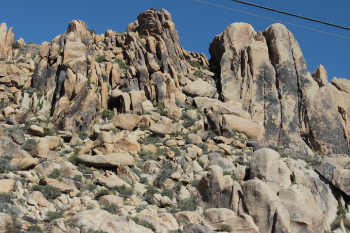
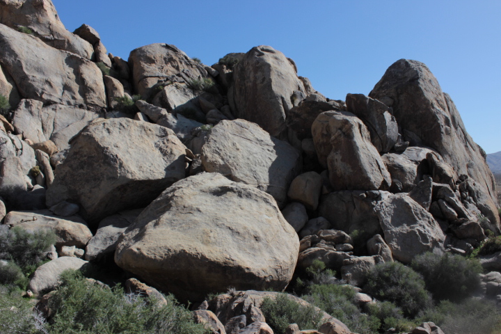
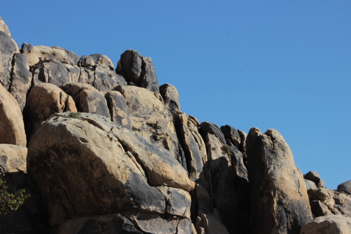
Aliso and Wood Canyons Wilderness Park is a jewel of solitude and natural beauty in hectic Orange County.

It comprises approximately 4,500 acres of wilderness and natural open space land. Originally, part of the Juaneno or Acajchemem tribal land, it later was owned by Don Juan Avila, Louis Moulton, the Mission Viejo Company, and now is under the jurisdiction of OC Parks.

Within the park lands are mature oaks, sycamores, and elderberry trees, two year-round streams, and over thirty miles of official trails. Many rare and endangered plants and animals make this park their home. This park is designated as a wildlife sanctuary.

To get to the main trailhead for Aliso & Wood Canyons Wilderness Park, exit the 5 freeway at Alicia Parkway and head towards the ocean.

Of course it was imperative that we feed the child. Whether they’re four or thirty-two, the first thing they think about is FOOD! I had prepared a huge amount of food for the hungry traveler and we ate it at a picnic table near the entrance to the trailhead, under a canopy of old shade trees. He ate a couple of his favorite sandwiches: tuna with celery, apples, nuts, avocado, tomatoes, cheese, and lettuce — along with Lentil Cookies, Snickerdoodles, Veggie Chips, Persimmon Bread, and an apple and an orange. We never fail to marvel at the AMOUNT of food Angel Boy can pack away…and that doesn’t include the nuts and raisins for the hike.

What’s up with that kind of metabolism?

He eats so much and burns it all and needs to eat again every couple of hours or so. This is just his normal — I once took him to an endocrinologist to make sure his levels were OK, and we learned that he’s just an extremely efficient food user. All I can say is that he didn’t get that from me.

After almost eight miles, we drove home — exhausted –but in a good way, and restored by the fragrance of Southern California buckwheat and sage.

Of course it was time for dinner and another feast of epic proportions: the stuff of mom-joy, that’s for sure.
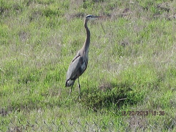
Great blue heron.

aliisobird
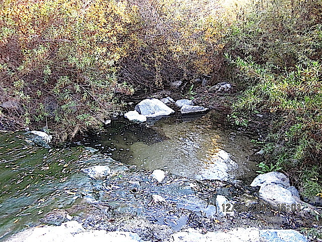
A hidden pocket of water.

Aliso1

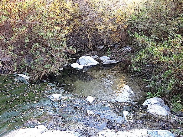
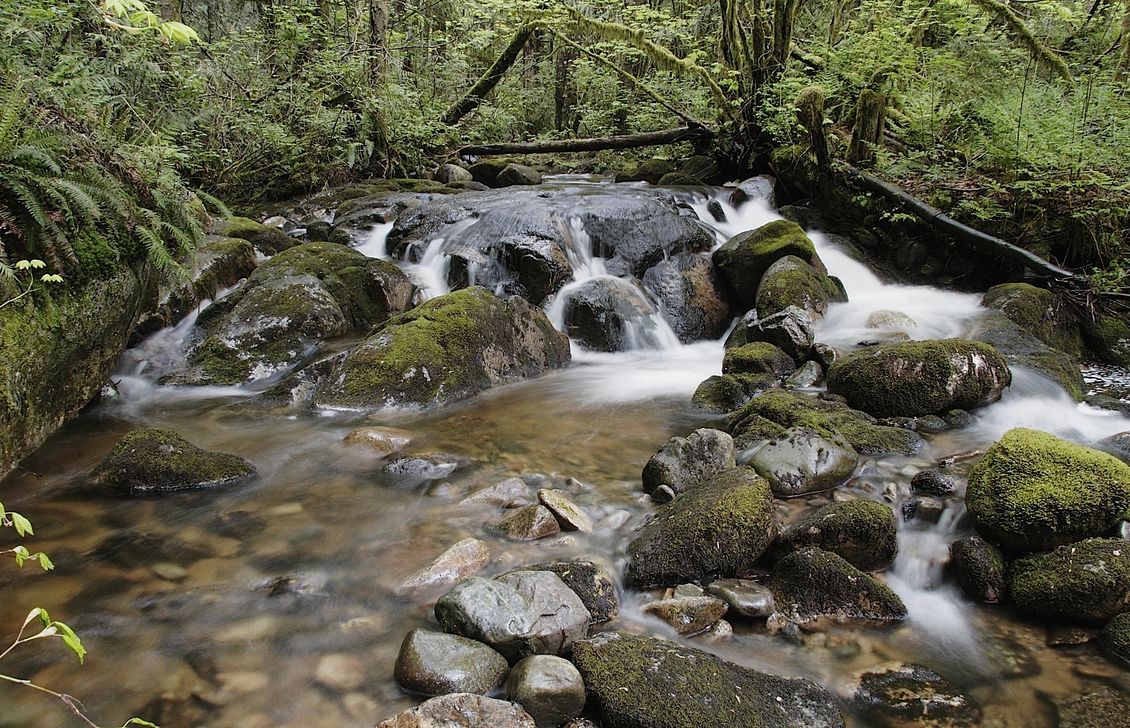
More water, rushing over rocks.

Aliso2

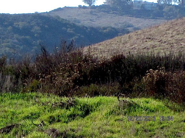
A gorgeous meadow and hills, but look at the houses on the hill.
So close to civilization!

aliso4
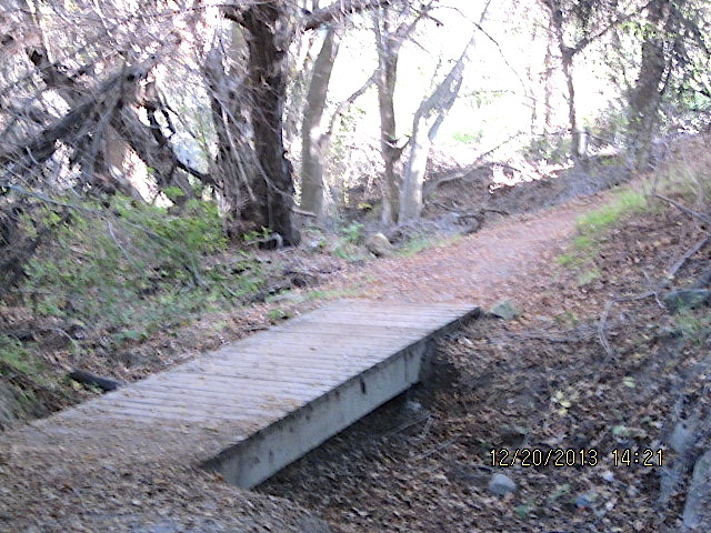
Fairy-like foot bridge.
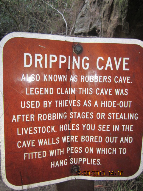
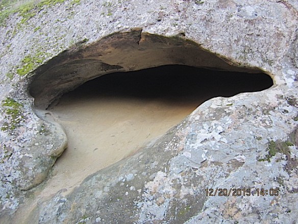
alisobridge

alisodrippingcave

alisocave

Another cool cave.

alisocave1

Some leaves DO change color in SoCal!alisotree

A happy mom ‘cos my Angel Boy was home,
even if only for a few days.

alisome

Wordless Wednesday — Moose Tracks — Don’t Murder Animals

Is it really Wednesday already? On my way to a Pilates class, here’s my contribution:

Moose Resting in Tall Grass in Grand Tetons.

moose

He didn’t move all day. He was about ten feet from the trail when we began our hike and four hours later, he was still there. We watched him for a while, admiring his rack (ha ha) and wondered how anyone could kill such a beautiful creature and mount the antlers on a wall for decoration. 

It hurt our heart and soul to think that if this lovely animal wandered off the protected lands of Grand Tetons National Park, he’d be slaughtered.

If I was anti-hunting before this trip, I have become (if possible) even more militantly against animal murder.

At the risk of offending anyone, I’d like to suggest that hunters have sociopathic tendencies. That opinion was derived from an animal rights group and it resonates with me. 

I guess this wasn’t so wordless after all.

Hiking in Julian

Broken wrist notwithstanding, it was time for a back-to-nature adventure; this time a seven plus-mile, four-hour walk.

We drove up to our local mountain to the beautiful and historic town of Julian to hike the Santa Ysabel Open Space Preserve, East End. The Cedar Fire in 2003 caused some damage that’s visible in a few burnt out trees, but most of it was spared.

Santa Ysabel East End Open Space PreserveTo get to the starting point from Julian, drive two miles north on Farmer Road to Wynola Road, jog briefly right, and turn left to remain on Farmer Road. Continue 1.2 miles north to the Santa Ysabel Open Space Preserve staging area on the left.

Start heading west, alongside the upper reaches of Santa Ysabel Creek, on the Kanaka Loop Trail. This part of the trail doubles as a segment of the unfinished Coast to Crest Trail, which will ultimately stretch all the way to the coast at Del Mar. It would be so cool to hike that one day.

Right away you’ll notice cattle — as in COWS — grazing on the grassy hillsides overlooking the creek. Another not-quite-natural occurrence is the appearance of large flocks of wild turkeys. The 20,000 or so turkeys now roaming the Julian-Cuyamaca area descended from an initial population of about 300 that hunting enthusiasts  animal murderers introduced in 1993.

I forgot my camera in the car, so here’s my embarassingly poor rendering of the cows and turkeys we saw.

Don't I draw like I'm five-years-old?

Artist: Princess Rosebud …Don’t I draw like I’m five-years-old? Obviously, both sides of my brain are not evolved equally.  It’s a good thing I don’t shop like I draw.

We saw sycamores, black oaks, and blackberry thickets. It’s a very active site for mountain lions – prints were everywhere along with a lot of coyote and mule deer scat.

The cows have an amazing playground; why they chose to sit in the middle of the trail along the entire route and either give us dirty looks or cause us to walk into the brush to get out of their way or in one case, CHASE US, I have no idea. They are VERY large and appear malevolent as if they know how big they are and were laughing with each other at my FEARFUL screams of “Go away, go away, shoo, shoo, get out of here, you stupid Cow!”

Geez, we don’t even eat meat, so they should have been extra nice to us, don’t you agree?

If I had my camera, I would have taken pics like this…

Kanaka Loop

Other people’s pics

It was a beautiful hike, not too strenuous for my still-healing broken wrist, and we decided to drive the few miles into Julian and walk around like tourists. Julian is an old mining town and is quaint and cute. We went into a one hundred year old soda shop and had a yummy sarsaparilla.

Now I have my camera again.

We gave this guy a few dollars for his animal rescue, ‘cos his little mini-pony was adorable. 

minipony

Carriage ride
Julian realty
Our fun day ended with a stop at a farm stand. Twenty-five avocados for $5.00. Yay! Guess who’s making guacamole?
avocados